2025 · Undergraduate researcher · Gator Glaciology Lab
MCMC Geostatistical Inversion
Geostatistical MCMC inversion of subglacial topography — exploring radar, velocity, and mass-balance fields to reconstruct realistic, mass-conserving beds beneath the Bindschadler & MacAyeal ice streams.

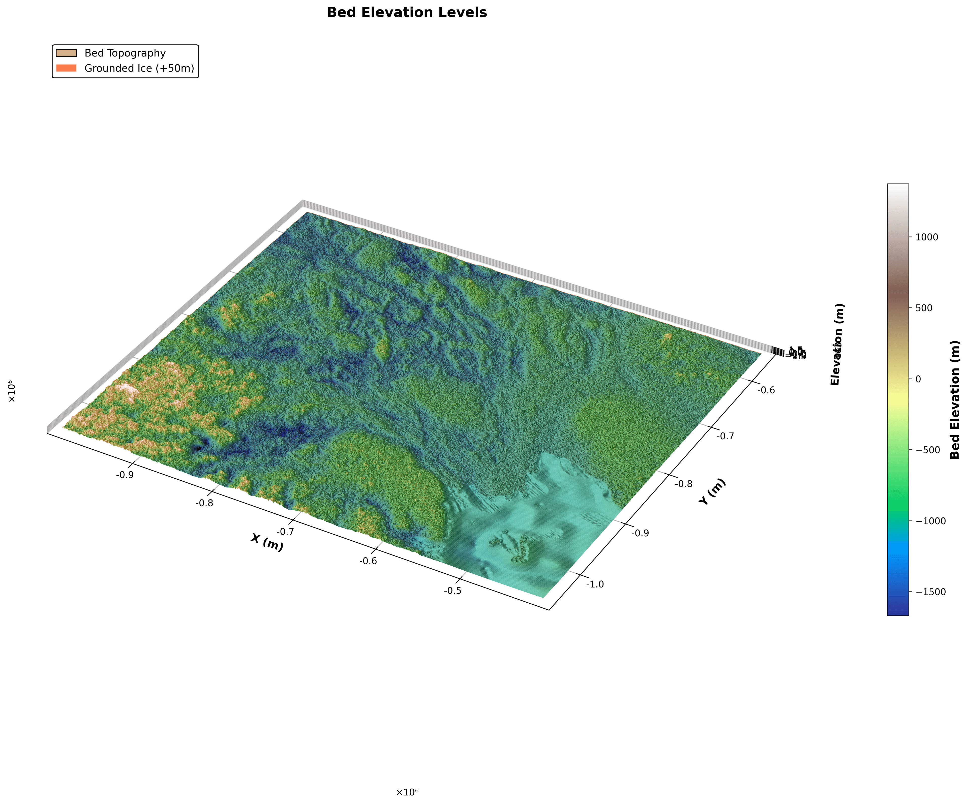
Research with the Gator Glaciology Lab reconstructing the bed topography beneath the Bindschadler and MacAyeal ice streams in West Antarctica. Standard baselines like BedMap and BedMachine lean on block kriging, which smooths away the extreme values radar actually measures and introduces flux-divergence artifacts. Artifacts introduces a problem where "sticky spots" drive abrupt shifts between slow- and fast-moving ice, hence, creating discrepancies in how researchers estimate melting ice and water going out of an glacier.
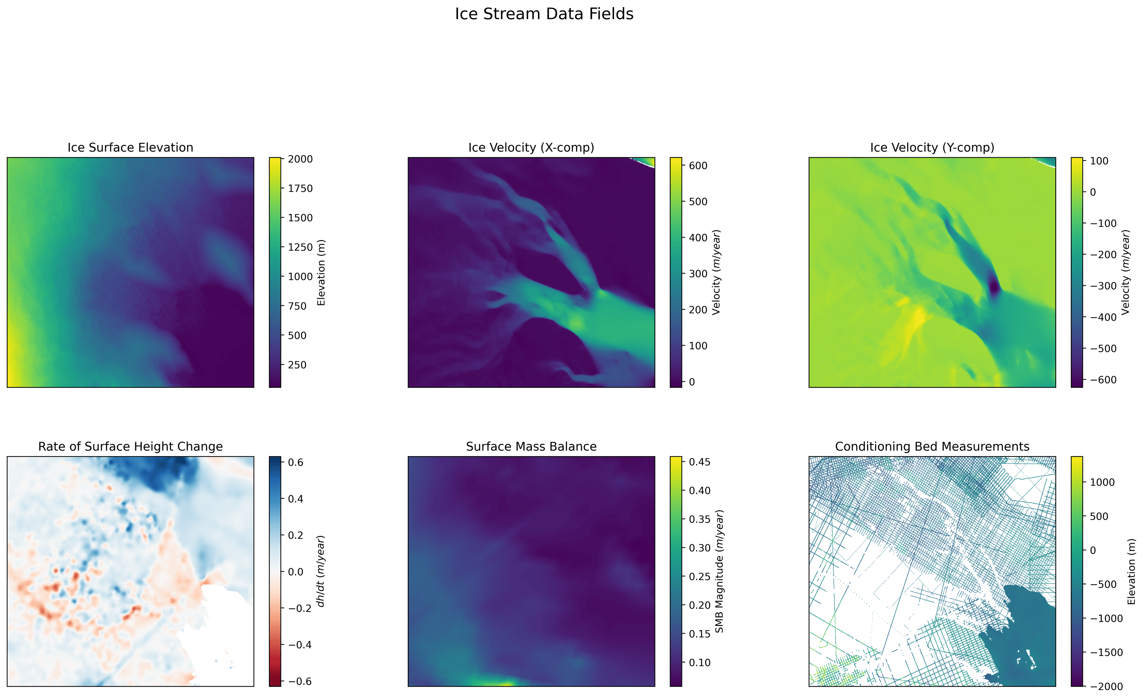
Most of the work was data exploration, including assembling and interrogating the geophysical fields for the study area -- ice-surface elevation, InSAR surface velocity (x and y), rate of surface-height change (dh/dt), surface mass balance, and scattered radar bed picks -- and characterizing their spatial structure. I ran experimental variogram analysis to quantify spatial correlation, fit a Matern covariance function, and used simple kriging as a baseline surface before introducing MCMC.
From there I experimented with a dual-chain MCMC approach (Niya Shao et al., 2025), a large-scale chain that fixes low-frequency trends and mass-conservation / flux-divergence anomalies, and small-scale chains that reintroduce realistic high-frequency roughness via Sequential Gaussian Simulation. The objective balances radar measurements, ice velocity, dh/dt, surface mass balance, grounded-ice and conditioning constraints, and mass-conservation uncertainty.
Over ~35 million iterations the large-scale chain drove the mass-conservation loss down to BedMachine's baseline threshold while preserving radar-consistent roughness, with the largest bed adjustments concentrated in the high-velocity region. The framework is modular Python + Jupyter, adaptable to other datasets, scales, and regions.
Working with incredible mentors and faculty, Niya Shao, Michael Field and Emma Mackie, I am currently continuing this work: utilizing multiprocessing and GPU parralelization across 100+ chains to generate a physically-informed topography on the broader Antartica.


OUTCOME
Drove mass-conservation loss to BedMachine's baseline over ~35M MCMC iterations while preserving radar-consistent bed roughness across the study area.